
The mere mention of the Demilitarised Zone (DMZ) between the Republic of Korea (South Korea) and the Democratic People’s Republic of Korea (North Korea) triggers excitement and wonder. Considered the most hostile border in the world, it is heavily guarded by troops from the U.S. and the two Koreas and witnesses border skirmishes and infiltrations even today.
The DMZ was established in 1953 by the Armistice Agreement when both sides agreed to formally end the Korean War and to retract 2 km inward on either side of the Military Demarcation Line (MDL). The United Nations Command (UNC), the Korean People’s Army (KPA), and the Chinese People’s Volunteer Army (PVA), were the signatories. However, they did not sign a peace treaty or reach a truce and the two Koreas are still technically at war.
Last month, I had the privilege of visiting the DMZ and the experience was enlightening.
The zone has restricted civilian access and only guided bus tours with a fixed itinerary are allowed. These have to be planned at least a month in advance. There are military watch towers and hidden outposts along both sides of the approach road. As the bus entered the zone, an armed South Korean soldier reviewed the passports of the passengers and gave us clearance. Our personal information had been shared with the civilian control checkpoint in advance and we were asked to maintain decorum and respect the significance of the area.
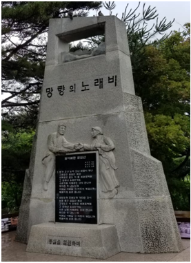
After crossing the checkpoint, we reached Imjingak. Located about 54 km from Seoul, it is the last village before the DMZ and has been the site for unification drives and peace initiatives for several years.
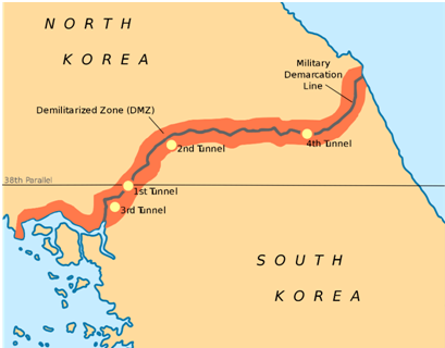
There are four stops along the DMZ – the Freedom Bridge, the Dora Observatory, the third infiltration tunnel and the Dorasan Station.
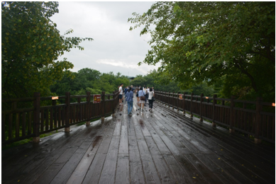
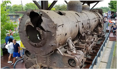
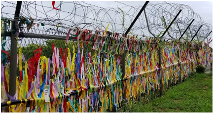
Our first stop was the Freedom Bridge, a popular spot in this village. It is a wooden bridge that was used by prisoners of war and soldiers to cross over from the North after the Korean War. Right next to the bridge, still visible, is a damaged locomotive, a remnant of the war, and a memorial site for slain South Korean soldiers. There is a row of barbed wire fences, now covered with colourful ribbons, carrying prayers and wishes for unification. Since this area has restricted access, it has become home to different varieties of flora and fauna over the years.
The DMZ has undergone a significant revamp in the last few years to attract tourists. Imjingak has a fully developed Peace Park for children, souvenir shops, restaurants and an observation deck. Despite the tourist-friendly façade, there are signs everywhere, warning tourists of hidden landmines. The presence of armed soldiers is often intimidating.
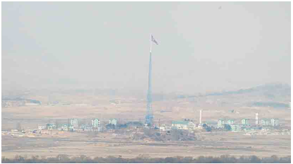
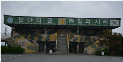
The next stop, the Dora Observatory, was a five-minute drive away from Imjingak. Located at the top of Mount Dora, it provides a direct view into North Korea, the most politically isolated nation in the world. Using high-end binoculars, one can see a propaganda village and the North Korean flag on the other side. The propaganda village was built by North Korea in the 1950s to resemble settlements by civilians and prevent any action or attack from South Korea in case a border skirmish escalated. However, incomplete construction and the lack of vehicle activity tell the real story. The observatory has a hopeful tagline, though: ‘End of separation and beginning of unification’.
The Unification Village, another symbol of the unification efforts, is situated within the South Korean side, towards the north of the civilian area and is largely occupied by war veterans.
In the 1970s, South Korea discovered four infiltration tunnels, constructed by North Korea to cross into the DMZ, following a tip from a North Korean defector. This revealed a plan to make a direct, unnoticed attack on the capital city of Seoul. This was at a time when the two sides were conducting peace talks. These tunnels are now open to tourists who can enter via open railway carts or on foot.
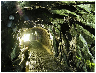
A visit to the third Infiltration Tunnel, our third stop, was exciting and eerie at the same time. The tunnel stretches over 1.6 km, has a height and width of 2 m and is at an inclination of 11 degrees. Tourists must wear helmets and crouch through a major portion of the tunnel. It’s cramped! The tunnel was built to enable around 30,000 troops and artillery to make their way to Seoul in an hour. When the tunnels were discovered, coal had been smeared on the walls and the floor to make them appear like disused coal mines. These marks are visible even today.
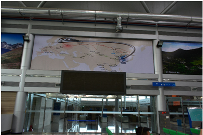
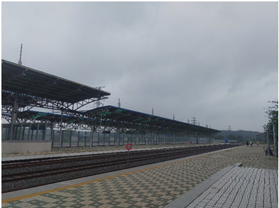
Dorasan Station, our last stop, highlighted another failed attempt by South Korea to unify with the North, but also revealed its optimism for unification in the future. It is the last railway station on South Korea’s domestic railway line, the Korail, and is connected to major cities in South Korea. The infrastructure for the international part of the station is complete with immigration and security check counters and railway tracks venturing into the North. For a short while between 2007 and 2008, freight lines ran between the South and the Kaesong Industrial Region, a Special Economic Zone (SEZ) created in the northern part of the DMZ, to promote trade and commercial exchanges. But these were closed down in 2008 after North Korea refused to give up efforts to build its nuclear capabilities.
The tracks still exist in the hope that the railway route will lead all the way to Europe one day, passing through Pyongyang. At the station, one can buy a ticket to Pyongyang, get the symbolic North Korean ‘visa’ and walk onto the Dorasan Unification platform to witness the historic railway linkages.
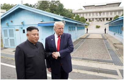
The DMZ recently came into the world’s view when U.S. President Donald Trump visited the Panmunjom area of the DMZ and crossed over to meet North Korean Supreme Leader Kim Jong Un on 30 June 2019.
This is called the Joint Security Area (JSA), which is the closest point to North Korea to which a tourist can reach. Occupied by the South Korean and U.S. militaries, it is the neutral zone where the Armistice agreement was signed and where diplomatic engagements take place. A tour of this area requires special clearance and is not open to tourists from all countries. Here soldiers from both sides stand, facing each other, in unsettling silence. We could not visit the JSA.

Every stop on the DMZ tour symbolised South Korea’s attempts at unification over the last 70 years. It gave us a glimpse into the Korean War, the shared history and the atrocities of the war. We drove back to Seoul, filled with new knowledge about the region, hopeful that the attempts at unification will one day bear fruit.
Purvaja Modak is Researcher, Geoeconomic Studies, and Manager, Research Office, Gateway House.
This blog was exclusively written for Gateway House: Indian Council on Global Relations. You can read more exclusive content here.
For interview requests with the author, or for permission to republish, please contact outreach@gatewayhouse.in
© Copyright 2019 Gateway House: Indian Council on Global Relations. All rights reserved. Any unauthorized copying or reproduction is strictly prohibited.